



New Zealand - can beautiful get even more beautiful? Exploring the South Island
Put simply, New Zealand is two islands: the North and the South. The South Island is considered the more beautiful of the two. I will share my impressions and you can judge whether you prefer the first, which I described in another post, or the second, which I write about here.
By ferry across the Cook Strait to Picton

My post about the North Island ended with us waiting for the ferry that links Wellington (north) with Picton (south). We didn't have much choice, because the more convenient sailings were sold out, so we were waiting for the ferry leaving at 3.30 in the morning. We decided to take a nap in the car at the port. We were woken by a knocking on the window. Night, a port, a flyover under which we had parked the car... and a sudden knocking. Being woken so abruptly, a lot of unpleasant thoughts flashed through our heads in a split second. It turned out that a kind passenger from another car wanted to let us know that our car's lights were on. His kindness gave us quite a fright. Two ferry companies (Interislander and Bluebridge Cook Strait) link the two islands, and their ferries make the 3-hour crossing 7 times a day. Tickets are not cheap: for a car, 2 adults and a child we paid $360. An alternative is to get around New Zealand on budget airlines and hire a car when you land. We covered the whole Auckland - Christchurch route by car, having arranged in advance to return the car somewhere other than where we picked it up. We drove 2,350 km. But back to the ferry crossing. Crossing the Cook Strait is a huge navigational challenge because of the strong currents between the Tasman Sea and the boundless waters of the Pacific, and the many islands and islets off both shores. On the other hand, this crossing is counted among the most scenic sea journeys in the world. Provided you don't sail in the middle of the night.
 Watch on YouTube
The little town of Picton is surprisingly quiet and peaceful, considering that it is home to a port handling huge ships. It is worth strolling along the waterfront, stocking up on supplies or... playing on the big pirate ship built for the amusement of kids and others who are young at heart.
Marlborough Sounds and the Queen Charlotte Track

In the far north of the island there are places you simply have to see: the Marlborough Sounds and Abel Tasman National Park. The first looks like a shredded Swiss cheese, where pieces of land shaped into sharp-edged peninsulas cut into the sea, creating bays scattered with a jumble of islets. The 71 km Queen Charlotte Track runs through the Marlborough Sounds and can be done on foot or by mountain bike. Many people prefer to admire the views and enjoy nature from sea level, so you often see groups of kayaks gliding silently along the coast. Yet another option is to drive the Queen Charlotte Drive, which will probably take you half a day with stops, even though the route is only 35 km long.
Abel Tasman National Park and water taxis

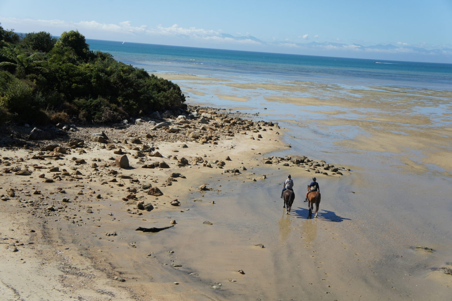
For me, Abel Tasman National Park is a must on any trip to New Zealand. Idyllic beaches that can easily compete with the most beautiful ones in South-East Asia, rainforest, and suspension footbridges over streams. If time allows, it is worth walking the famous Abel Tasman Coast Track. It is 60 km one way, and you need to allow 3 - 5 days for it. You have to carry everything you will need for those few days, especially a tent and food. You sleep at small campsites, often just a step from the beach.

Crossing one of the bays depends on the tide times. In practice this means you can only cross it with dry feet for 3.5 hours a day: 1.5 hours before low tide and 2 hours after the water starts rising again. If you don't have that much time, you can cover part of the route by water taxi.
 Watch on YouTube
Water taxis are large motorboats that run between the tourist information point and the individual bays, arriving and departing at set times. If you go to Bark Bay, you can take a nice walk to the suspension bridge, passing a beautiful deserted beach on the way. A good idea is to use the service to sail to one bay, walk a few kilometres and come back from another. On the way, the skipper will take you close to an island that is home to a colony of seals and show you a geological curiosity: a round boulder split into two equal halves, sitting on top of a rock in the sea. Of course, there is a beautiful Māori legend that tells the whole story. (I have devoted a separate post to the Māori.)

We would really like to stay longer in each of these places, but time is pressing and there are still several attractions ahead of us. We have to give some places a miss. For example, we won't be sampling the excellent New Zealand wines at the vineyards that have taken over the area south of Picton and Nelson.
Pancake Rocks in Paparoa National Park
Leaving the north coast and heading south along the western side of the island, we reach Paparoa National Park and the famous Pancake Rocks. It would be interesting to drive down the eastern side towards Kaikoura, where you can go out to sea to watch whales. But, firstly, there was the time, and secondly, the road along the east coast was impassable because of earthquake damage.

If you imagine a stack of pancakes piled one on top of another, in your mind's eye you are already among the Pancake Rocks. Layers of hard and soft rock erode at different rates, hence the distinct, endlessly repeated grooves. Another feature of this area is the huge holes that form in the rocks, through which a great fountain of water, forced in by the sea, shoots up again and again. Driving from north to south, we pass signposts to a seal colony. From wooden platforms you can watch the bigger animals basking in the sun or the little ones frolicking in small rock pools. It is worth having binoculars to hand and fitting your camera with a telephoto lens to get these mammals within arm's reach.
Shanty Town - gold panning near Greymouth

At Greymouth our route turns sharply east and crosses the whole island to reach the big city of Christchurch on the other side. An interesting, though not nature-related, stop just beyond Greymouth is Shanty-town. It is a replica of a gold miners' town with buildings and equipment from the 19th and 20th centuries. Through everyday objects and photographs, this open-air museum shows the life of gold prospectors between the 1850s and 1940s, many of whom were immigrants from China, so it is no surprise to find a small Chinatown on the edge of the site. The largest exhibit, still very much alive, is a mighty steam train running between two stations. There is a period-style hospital and post office, but the biggest attraction, apart from the train ride, is the chance to play a real gold prospector and pan for flakes of the precious metal under the eye of a professional instructor. When we were buying tickets for this activity, the ticket seller winked at us and assured us that we would definitely find gold flakes in the sand we panned. And so it was: a small vial with flecks of gold inside is now a treasured souvenir of the trip.

Arthur's Pass and the Castle Hill rocks
Driving across the island from west to east, we encounter another major attraction, this time in the mountains rather than by the sea. The road winds picturesquely through the valleys, climbing higher and higher until it finally reaches its highest point (920 m above sea level), known as Arthur's Pass. The surrounding area is Arthur's Pass National Park, which lets you see the differences between the western and eastern sides of the pass. The differences in vegetation are mainly due to the intensity of rainfall; the western side gets much more of it. 16 of the surrounding peaks exceed 2,000 m above sea level, and there are numerous waterfalls that can be reached on well-marked paths. This area is also home to the mountain parrot, the "kea". When we stopped for a short break, one of these ringed birds was circling between the cars. You have to keep an eye on it, because it loves using its powerful beak to pull out the rubber seals in doors and windows.

From Arthur's Pass we head down to Christchurch. On the way there is one more stop at Castle Hill, a cluster of rocks that, with a little imagination, can resemble a medieval castle. The boulders scattered across the hillocks form a labyrinth, and the views are stunning.
Christchurch after the earthquake
Christchurch is a strange city, deeply scarred by the last powerful earthquake in 2011. Many buildings, including the cathedral in the city centre, were destroyed and 185 people died. The face of the city has changed: it lost many important buildings but also gained new ones. Among the intriguing new projects are the new "Cardboard Cathedral" and the "Restart" container shopping centre. Designed by the Japanese architect Shigeru Ban, the temporary cathedral is now a major attraction. Many people want to see its "cardboard" interior, where the huge tubes of reinforced paper holding up the roof are particularly striking, as are the beautifully lit stained-glass windows at the front, which can be admired after dark.

"Restart" is another "makeshift" solution that the locals have come to love. Hastily set up right after the earthquake, the containers placed side by side and stacked on top of each other were meant to serve as an emergency centre housing offices, banks and aid points. Over time the place gained character: little bars and shops appeared, and street musicians began to take over the small squares. Today, despite plans to remove the cluster of containers, it has a life of its own, attracting both locals and tourists.
Another, intangible, consequence of the earthquake was the arrival of many members of the artistic bohemia. In the ruined city they saw an opportunity to realise their artistic visions. This came true above all in the blossoming of street art and the creation of many large-scale murals.

You need to set aside plenty of time for New Zealand. There are countless attractions here, especially natural ones. The North Island is beautiful, but the South Island is more beautiful; if you are forced to choose, you had better head south. I was enchanted by the landscapes, by nature seen from afar and up close, and by the clarity of the air. New Zealand cannot be dull; it can only be beautiful or more beautiful.


